Category: ModMon monitoring (Page 1 of 2)

Neuse River Estuary Conditions 13 Oct 2020

Hi all,

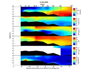
Our crew was out Tuesday, 13 October 2020. The estuary was stratified with pockets of hypoxic water observed near New Bern at station 30 and near the bend at stations 100 and 120. The fluorescence probe that measures chl-a failed mid-cast at station 140 and all chl-a data upstream of 140 was removed due to meaningless, negative values. A bloom at station 70, however, was indicated by the high near surface DO, observation of brown water color, and clogging of filters back in the lab. The crew observed fish actively dying south of Fairfield Harbor (our station 70) and fish dead on the surface from there to mid-channel north of Slocum Cr. (our station 100). The dominant species in the bloom, the dinoflagellate Gyrodinium instriatum aka Levanderina fissa)  is not known to be toxic. G. instriatum is the most common bloom former in the Neuse during the summer and early fall and hasn’t previously been associated with a fish kill. This fish kill appears to have been ongoing since 30 September.

Best,

Nathan

Neuse River Estuary Conditions

Hi all,

I’m playing catch up again.

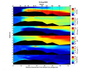
Conditions on 18 August were about as stratified as they get in the Neuse. From New Bern to the mouth bottom water salinities were more than 10 ppt greater than at the surface. The pycnocline increased in depth from about 2 meters at New Bern to 5 m at the mouth, and waters below the pycnocline were hypoxic/anoxic along that whole stretch. Overall, chl-a levels were low but there was a broad zone of moderate 10-20 ug/L at the surface that extended from station 60 to station 140. A subsurface, thin layer of chl-a > 40 ug/L was observed at station 70. (image below)
 

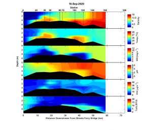
After ~20 kt winds from 14-15 Sep. and continued ~15 kt winds on 16 Sep, the estuary was much more mixed on 16 Sep. There were pockets of stratification and hypoxia near New Bern and near the bend at stations 100 and 120. These pockets of hypoxia were associated with waters that were warmer than surface waters and saltier than downstream bottom waters. It’s not unusual for bottom waters to be warmer than surface waters during the fall as the surface loses heat to a cooling atmosphere. It is weird to see higher salinity upstream, and may reflect cross channel variability that isn’t being captured by our down-channel transect.  Chl-a was moderate (10-20 ug/L) from New Bern to the mouth. (image below)
 

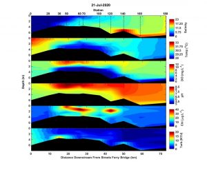
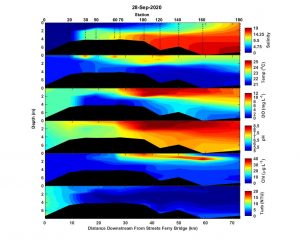
On Monday 28 Sep, the estuary was highly stratified again. Bottom waters were 2 mg/L or less from New Bern to about station 70 and were ~4 or less from station 70 to the mouth. A broad zone of elevated surface chl-a was observed from station 60 to station 140, with a surface maximum of ~40 ug/L at station 100. Downstream of station 100, maximum biomass occurred as a subsurface maximum at 1 to 2 m depth. Two days later on 30 Sep., a fish kill was reported on Flanners Beach. Water from the location of the kill contained high concentrations of the potentially harmful raphidophyte species, Heterosigma akashiwo. Microscopic observation of surface water from station 100 contained very few Heterosigma akashiwo cells. The community was primarily cryptophytes, dinoflagellates, and small diatoms that are typical for this time of year and not known to harm fish. During an unrelated sampling trip on 2 Oct., I observed an ongoing fish kill near the mouth of Slocum Cr. There was a mix of actively dying and menhaden that had been dead for a day or two. I microscopically examined water samples collected from the fish kill area and from the Neuse outside the fish kill area. Low concentrations of Heterosigma akashiwo were present but the low observed concentrations have not been previously related to fish kills. (image below)
Stay well,

Nathan
Paerl Lab research featured in Coastwatch magazine

The Fall 2020 issue of Coastwatch (NC Sea Grant magazine) features some of the long-term water quality research performed in the Paerl lab. The article, titled “Science Needs You“,  highlights the necessity for research of the second largest estuarine complex in the United States and how you can help accomplish the goal of continued research  to track the health of the Neuse River Estuary.  Whether you live locally or visit the area’s beaches or protected forests, you can make an impact to improve the land and water we enjoy!

This article features a chapter from Dr. Paerl’s water quality monitoring book, North Carolina Science Adventures for the Everyday Explorer: Thirty Great Places to Learn About Environmental Science in Our State. Check it out for other fascinating information about the Neuse River Estuary region!

Big THANKS to NC Sea Grant for highlighting our important work!

Neuse River update

Hi all,

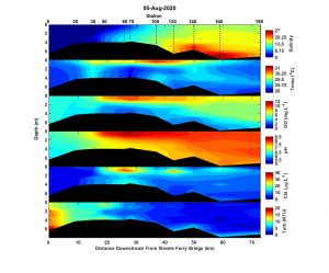
August 5th was a couple days after Hurricane Isaias made landfall and tracked across the Neuse River watershed.  On August 5th, stratification was much weaker than two week’s prior. It appears that the major impact of Isaias was wind mixing. Hypoxic/ anoxic bottom waters were not observed. There wasn’t a lot of precipitation associated with Isaias and that’s reflected in the moderate salinity levels and the salt wedge extending upstream all the way to New Bern. There were moderate intensity (chl a ~30 ug/L) subsurface peaks in chlorophyll a at stations 60 and 120.

Since, August 5th the Neuse flow has steadily increased to near flood stages. Part of this may be due to Isaias but most is likely due to a rash of high precip. thunderstorms centered over the upper Neuse basin. We’ll see how the estuary responds to the flow increase during the next sampling.

Stay well,

Nathan

Neuse River Update

Hi all,

The recent dry conditions have allowed salinity to creep up to New Bern in the bottom waters. The estuary is still highly stratified from New Bern downstream to station 120. True anoxic conditions occurred from New Bern to station 100, just upstream of the bend at Minnesott/ Cherry Branch. Bottom waters in this area smelled strongly of sulfur indicating that there was essentially no oxygen present. Elevated chlorophyll a occurred at the surface at station 50, and as a subsurface chlorophyll maximum downstream to station 120. Microscopic observation of surface water from station 50 indicated the bloom was a mix of small centric diatoms and nanoflagellates. The nanoflagellates were hard to identify but their morphology wasn’t consistent with any types of particular concern, e.g. toxin producing dinoflagellates.

Stay well,

Nathan

Neuse River Update

Hi all,
The estuary is extremely well stratified from New Bern to the mouth. The salinity difference is the major driver of the stratification, but a temperature difference of ~4 degrees C is playing an unusually strong role in reinforcing the stratification. Bottom waters were hypoxic from New Bern to the mouth. There were no reports of rotten egg smell from the bottom waters. So the bottom waters were probably hypoxic rather than anoxic. A zone of high surface chlorophyll occurred from New Bern (station 30) to where the estuary widens at stations 60 and 70. From there downstream there was also a subsurface chlorophyll maximum along the pycnocline. I haven’t looked to see what was blooming.
Nathan

Neuse River Update

Hi all,
The estuary looks almost exactly like it did two weeks ago. The upper region above New Bern is very turbid as flows are still much higher than normal for this time of year.  Surface waters are basically fresh to near the bend at Cherry Branch. The tip of the salt wedge is at station 50 just downstream of the HWY 17 bridge and the estuary is highly stratified ,and bottom waters were hypoxic from station 50 to the mouth. A broad zone of elevated chlorophyll a occurred from stations 100 to 160. Depth-wise the high phytoplankton biomass was maximum at about 1 m depth. This vertical patchiness is a tell-tale sign that the phytoplankton producing the peak is likely a flagellate seeking optimum light levels for photosynthesis. Our surface sample is collected at 0.2 m and missed the peak. I suspect it’s probably still an ongoing bloom of Gyrodinium instriatum.
Best regards,
Nathan

Neuse Update

Hi all,
The estuary continues to freshen with the 2020 spring deluge. Surface water salinity at station 140 near Oriental is only about 5. The tip of the salt wedge is still just below New Bern at station 50, and the estuary is highly stratified from there to the mouth. Bottom waters were hypoxic from station 50 to 140. A broad surface bloom extended from station 60 to 120. This is likely the same dinoflagellate bloom of Gyrodinium instriatum from two weeks ago. I’ll take a look when I’m in the lab next and will post a correction with the next report if I’m wrong. With the rain still falling, the estuary will likely stay very fresh, and the hypoxic zone may expand without some serious wind mixing.
Best regards,
Nathan

Neuse River Update- An early start to hurricane season with Tropical Storms Arthur and Bertha

Hi all,
The estuary is fresher now due to all the rain from Arthur and Bertha but the tip of the salt wedge still extends almost to New Bern. A strong pycnocline occurred at about 4 m depth at stations upstream of station 120 and at about 5 m at the lower stations. Bottom waters were hypoxic (< 2 mg/L) at station 50 -120, and were <4 mg/L at the lower stations. There was a zone of high surface chlorophyll from stations 70 to 120. Microscopic examination of station 120 surface water where chlorophyll was greatest showed that the bloom was dominated by the dinoflagellate, Gyrodinium instriatum (more correctly known as Lavanderina fissa). This dinoflagellate is our most common summer-time bloom former in the Neuse and is not known to produce toxins. The other phytoplankton in the sample were a mix of cryptophytes, small diatoms, and smaller dinoflagellates.
Nathan
« Older posts

© 2024 The Paerl Lab

Theme by Anders NorenUp ↑